


 Energy


Here’s Why Hurricane Milton Caused So Many Tornadoes
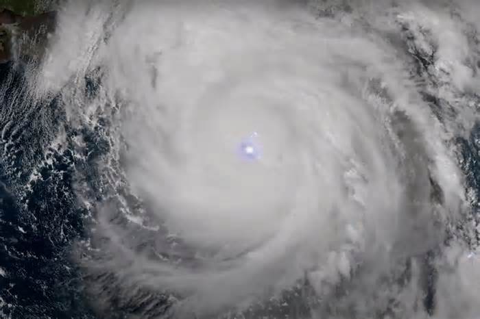
In contrast to the devastation on the ground, the imagery from space is jarringly beautiful. While footage of both hurricanes showed lightning sparking like fireflies across the storm clouds, it also shows how the storms formed in different ways. Images from September 24 show several thunderstorms converging into Hurricane Helene, which made landfall two days later, pummeling six states. In contrast, as Milton began forming, intense, continuous eyewall lightning can be seen in the storm’s core. The storm eventually became a Category 5 hurricane that did major damage across Florida.
In a statement, NOAA said the imagery and data collected so far is preliminary. The satellite, launched on a SpaceX Falcon Heavy rocket in June, is currently in post-launch testing—a phase where its instruments and systems are readied for full operation.
The fourth and final satellite in a series that began launching in 2016, it’s designed to monitor severe rain and snowstorms, wildfires, floods, lightning, dense fog, and other weather events. Once it’s fully operational, which NOAA said should happen in April 2025, it will replace its predecessor GOES-16 as GOES-East. The name is somewhat confusing, since the satellite is in orbit over the western hemisphere, but it’s all relative. GOES-East orbits over the 75th Meridian West, which is east of GOES-West’s orbit over the 132nd Meridian West. Smack dab between the two is the 100th Meridian, where the great plains begin. See? It all makes sense.
Please first to comment


Stay Connected
Tweets by elonmuskTo get the latest tweets please make sure you are logged in on X on this browser.